
Great Lakes – St. Lawrence River Information

Water levels data
Monthly water levels bulletin
Monthly water levels for the Great Lakes area and Montréal Harbour.
Monthly Water levels forecast
Water levels forecast for the Great Lakes.
Monthly Historical Great Lake Means
Historical monthly mean water levels for each of the Great Lakes.
Hourly water levels
Hourly water levels for the Great Lakes provided by the Marine Environmental Data Service.
Water level data web services
Web services for accessing official data on navigating modelled surface currents and water levels.
Services and information
The tide and water level gauge network
Description of and data from network of tide and water level gauges in the Great Lakes.
Great Lakes-St. Lawrence River system
Description of the lakes and channels that make up the Great Lakes-St. Lawrence River system.
Water circulation
Description of the circulation of water in the Great Lakes.
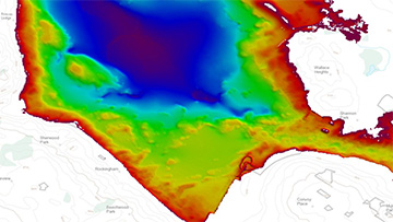
Fluctuations in water levels
Description of changes in water levels in the Great Lakes with historical charts.
Natural factors affecting water levels
How factors like precipitation and evaporation effect water levels in the Great Lakes.
What we are doing
Features
CHS Digital Transformation Initiative
At the Canadian Hydrographic Service, innovation is a guiding principle for the bold digital transformation initiative now underway.
Client suggested enhancements have been implemented to the CHS NONNA Data Portal including migration to chart datum and enhanced tools for selecting and downloading large geographic areas.
2024 Tide Tables Available Now
Download your 2024 Canadian Tide and Current Tables now to help navigate safely through Canadian waters.